Posts

This one map explains the entire worldwide economy

Image
A new map by the folks at HowMuch.net provides a fascinating perspective on the worldwide economy. The map represents each country relative to the size of its nominal gross domestic product, the type of GDP that is not adjusted for inflation. The larger the area, the larger the size of the economy. Each area is divided into three sectors — services, industrial, and agricultural — to visualize which industries contribute most to the country's GDP. The result is as follows: With a GDP upward of $17 trillion, the US comprises nearly a quarter of the world's economy. Using data from the CIA's World Factbook, HowMuch.net determined that most of that comes from the service sector (79.7% compared with a global average of 63.6%). Agriculture and industry make up below-average portions of the economy (1.12% and 19.1% compared with averages of 5.9% and 30.5%). China, on the other hand, has struck more of a balance between its service and in...

Google Doodle - Venezuela National Day 2015

Image
Venezuela's landscape is an entrancing one. From tropical waters and the Andes in the north, to rich Amazonian forests in the south, the country’s geographic diversity is nothing less than dazzling. No wonder, then, that one of its national symbols is a stunning natural specimen, a microcosm of Venezuela’s kaleidoscopic coloring: the araguaney. Indigenous to the country, this tree’s leaves explode into shades of gold, similar to the bold yellow hue striped across the Venezuelan flag. With today’s Doodle, we celebrate the nature, culture and people that call Venezuela home on this Cinco de Julio, Venezuela’s day of independence.

Next Stop: Chamonix

Image
Is a commune in the Haute-Savoie département in the Rhône-Alpes region in south-eastern France. It was the site of the first Winter Olympics in 1924. The commune's population of around 9,800 ranks 865th within the country of France. Chamonix is a winter sports resort town. As the highest European mountain west of Russia, Mont Blanc attracts mountain climbers. There is a cable car up to the 3,842 m (12,605 ft) Aiguille du Midi. Constructed in 1955, it was then the highest cable car in the world.

Summit Piedras Blancas, Venezuela

Image
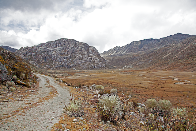
The Pico Piedras Blancas (also known as Misamán), at 4,748 metres, is the highest mountain of the Sierra de la Culata range in the Mérida State, and the fifth highest mountain in Venezuela. Its name, meaning "White Stones", is of doubted origin, since the massif is predominantly grey in color. Pico Piedras Blancas lacks glaciers, nevertheless, seasonal snowfalls may cover briefly its flanks. From its summit and under clear conditions, Lake Maracaibo is perfectly seen. One of the accesses to reach the base of the mountain, passes through the Mifafí Condor Reserve, which hosts some specimens of this andean bird.

Cerro Autana (Autana Mountain)

Image
Is a geological formation located at the western portion of the Guiana Shield in the Estado Amazonas, Venezuela near the Colombian border (approximate coordinates 04°51′33.61″N 67°27′05.51″W). It is characterized by a narrow base, a flat top and almost vertical walls. Its top is at approximately 1220 meters (4003 feet). It belongs to the formations known as tepuis which are characteristic flat-top mountains of the Guiana Shield. Cerro Autana (Wahari-Kuawai ) plays the role of the "tree of life" in the oral history and lore of the Piaroa Indians which inhabit the region.

Natural Monument Stone Turtle

Image
Is a protected natural area located in the municipality Atures, in Amazonas state, Venezuela. It is located approximately 15 km from Puerto Ayacucho, southward. Municipality Atures. Covering 1,950 hectares, in her are settled two indigenous communities Hiwi (Guahiba) and Piaroa.

Laguna de Canaima

Image
Located in the region known as the Gran Sabana, in the protected area called Canaima National Park, Bolivar State southeast of the South American country of Venezuela. Its waters come from up to seven waterfalls and a river, surrounded by views of various tepuis (as Kusari, Kuravaina and Kurun) as well as vegetation. Plus it highlights the different colors of its waters that vary according to the sector.